Commissioned in 1932 from the old state highways 133 and 105, Route 20 was originally longer and straighter than now. Part of its former route in Barkhamsted is now under water; the road was shifted north almost into Massachusetts after the reservoir was created in 1940. The Tunxis Trail in the Tunxis State Forest follows the old Route 20 roadbed for a while, and there's even a short "Old Route 20" road in East Hartland. (See my Historical Route 20 map for details of the original alignment.)
In Windsor Locks, around the same time, Route 20 was shifted south to make way for an air base (now Bradley International Airport).
Continuing east in Windsor Locks, the old Route 20 crossed Route 75 on Spring Street, then followed Bridge Street (today's Route 140) across the Connecticut River into East Windsor. Turning north on Main Street, Route 20 then met US 5 and followed it to Enfield. There, Route 20 turned east, following present-day Route 190 east to old Route 15 (today's Route 30) in Stafford; and overlapped with 15 to end at Route 32. When Route 15 moved southeast to the new Wilbur Cross Highway in the 1940s, Route 20 temporarily extended further east.
New Bradley Airport Connector spurs route changes
The $3.9 million Bradley Airport Connector, planned since the early 1950s, opened July 3, 1961. The four-lane freeway leads from Interstate 91 to the southwest entrance to Bradley International Airport. The road was apparently planned to intersect I-91 further north, closer to the Dexter Coffin Bridge over the Connecticut River, but a 30-acre tract of land in the area had been set aside for a shopping center.
In 1961, Route 20 was rerouted along the connector to end at I-91, Route 140 was rerouted into Windsor Locks, Route 191 was moved south, and Route 190 inherited the Enfield-Union Route 20. The spur from Route 20 to the airport is designated SSR 401, a number that is not signposted.
The connector crossed the Windsor - Windsor Locks town line multiple times, leaving small pockets of each town on the opposite side of the freeway. In 1965, both towns agreed to exchange these portions, and define their common border to run along the center of the highway.
Proposing an expanded 20 freeway
From at least the early 1960s, state and regional planners have thought about extending the Route 20 freeway in both directions to serve northern Connecticut towns.
In 1961, the state's long term plans included investigating a long route I would call a "rooftop highway", extending from US 44 in Barkhamsted over to the airport connector; then after a northward overlap with I-91, an eastward extension along today's Route 190 to I-84 in Union.
Also in 1961, the Proposed Long-Range Expressway Plan of the Hartford Area Traffic Study outlined a bypass route (not numbered on the map) leading from US 44 in Barkhamsted, through Granby and East Granby, continuing along the Bradley Airport Connector, crossing the river into East Windsor, then veering south in Vernon to pass through Bolton, to end at Route 2 in East Glastonbury. As the only constructed part of this route in Windsor Locks was Route 20, it's possible the entire route might have taken that number.
In 1962, the Tri-State Transportation Committee recommended a 6-mile Route 20 freeway, from Routes 9 and 10 in Granby to I-91 in Windsor Locks, including the recently opened airport connector.
In 1967, the Capitol Region Planning Agency unveiled a shorter but still ambitious plan. To the west, Route 20 would be extended into Granby, running south of current Route 20, and ending west of Granby center. To the east, Route 20 would cross the Connecticut River on a new bridge, touching down in East Windsor near Stoughton Street. It would slip south of Route 74 in Rockville, then continue east to end at I-84 just across the Tolland town line.
In late 1967, Rockville officials were pondering the proposed "Bradley Field Connector", slated to run through the center of town. There could be a benefit to displacing older, run-down sections, with the state "paying the slum-clearance bill"; yet the highway could also sever the community, with one side or the other suffering from the split.
Seethe Hartford's Proposed Freeways map for a very approximate description of the Route 20 proposal.
If all the 1967 proposals had been constructed, Route 20 would cross several other freeways: Route 10, Route 189, I-91, US 5, Route 83, and end at I-84. It would serve as part of an outer beltway for Hartford (though a complete outer beltway was not proposed).
A new interchange at I-91
The original 1961 interchange at I-91was a small trumpet with single-lane connecting ramps. In 1994, as part of reconstruction and widening on I-91, the interchange was rebuilt into a semi-directional T interchange with dual-lane flyover connections. In addition, a new interchange was added on Route 20 at Old County Road (immediately west of I-91).
More on Bradley Airport
As the 1940s started, the US Army sought to build a series of air bases to defend New England. In 1940, Dexter Corp. president Dexter Coffin optioned 260 acres of tobacco fields in Windsor Locks and proposed the state build an airport there.
In January 1941, the General Assembly voted to buy 1,681 acres and extend a 25- year lease to the federal government. Congress released $2.6 million to fund the project, and construction of the Windsor Locks Air Base began in March. The base housed the 57th Pursuit Group, flying P-40C Tomahawks.
The air base was later named Bradley Field after Lt. Eugene M. Bradley, who perished in a crash while training near the airport. Now the official name is Bradley International Airport, and the diminutive-sounding "Bradley Field" is discouraged. After Gov. Ella Grasso died, there was a movement to rename the airport in her honor, but fortunately Bradley was left alone and nearby Route 75, now the Ella T. Grasso Turnpike, assumed commemoration duties.
Not known to many Windsor Locks residents is that the town once housed a German POW internment camp. Just south of the Connecticut National Guard hangar is a concrete base that once supported a POW guard tower.
And finally, Dexter Coffin himself did not pass unvenerated; his name graces the Interstate 91 bridge over the Connecticut River at East Windsor.
More on the Barkhamsted Reservoir
Here's a response from Paul Hart, Barkhamsted Historical Society, to my questions about when the reservoir was created, and what was displaced. There is one small ghost town under water!
"The Saville Dam, which backs up the Barkhamsted Reservoir, was completed in 1940. I believe it took several years for the reservoir to fill with water.
"The reservoir covers what was private land- mostly small farms. The
property was bought by the water company mostly during the depression years. On the Barkhamsted side, there was one village, known as Barkhamsted Hollow that was covered with water. This was located at a crossroads about a mile north of the dam and on the east side of the river. There was a store, church and a few other buildings here. Several roads were put underwater, including a north/south road that followed the river on the east side. There were many house locations that were covered by the water, and even more that were bought and torn down or moved that were not covered by water but were located on the watershed property now owned by the water company."


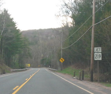 Approaching Route 219 on a lonely stretch of Route 20, on a cloudy day in Granby. Photo taken April 2004 by Kurumi.