Route Changes
Prior to the Great Renumbering of 1932, when Route 83 was designated, it was known as State Highway 164 from East Glastonbury to South Manchester, and SH 108 from Manchester to the Massachusetts state line. In 1932, Massachusetts also designated its part of the route as Route 83.
Route 83 has seen a few minor changes in alignment and maintenance over the years.
In late 1964, a half-mile segment at the southern terminus in Glastonbury was realigned for an interchange with the new Route 2 freeway. The original alignment, which included an unsafe curve, was being shifted eastward to a straighter, more level roadway. Some problems accompanied the move, starting with the contractor removing the old roadway before the new one was ready for use.
Furthermore, the state would not accept the new road into its highway system until it was connected to existing Route 83 -- and it turned out the contractor did not have the required permit to do that. Fortunately, the mess was quickly sorted out and motorists now enjoy free access between Routes 83 and 2.
In the 1940s or 1950s, a tight curve in East Glastonbury was bypassed by a new roadway across a small canyon; the old road is now Old Manchester Road.
In 1974, the dogleg with Route 94 in Glastonbury was realigned to a safer 4-way intersection. Route 94 was significantly realigned in the area.
Also in 1974, a new four-lane section of North Main Street was completed in Manchester, between Main Street and Oakland Road. The old Route 83, right next to the railroad tracks, is no longer a thru street.
Main Street in Vernon, south of I-84, appears to be an old alignment of Route 83, but this was abandoned before 1944.
Circa 1986, a rotary intersection at Route 30 in Vernon -- the "Vernon Circle" -- was replaced with a four-way intersection, in conjunction with the massive reconstruction of I-84.
Unsafe junction with Route 140 fixed
In 1977, the DOT considered the intersection of Route 83 and Route 140 in Ellington as one of the most dangerous in Connecticut, and announced it would seek federal funds to fix its problems. An incline on Route 140 eastbound at Route 83, and a sharp right turn for southbound traffic, created such a hazard that the town ambulance would routinely go west on Route 140 and use Route 286 instead to reach Route 83.
This was eventually fixed; Route 140 now meets Route 83 at a gentler four-way intersection across Cider Mill Road.
Maintenance Changes
The original Route 83 was a state-maintained highway only from US 6 in Manchester to the state line: a length (in the 1942 Highway Log) of 20.10 miles. The 1944 Log defines Route 83 starting at Route 2, for a length of 28.08 miles, but the portion south of US 6 was still town maintained. Some state maps in the 1950s and 1960s show Route 83 "missing" in southern Manchester and Glastonbury, though I believe the route was still signed along those portions.
In 1962, state maintenance was extended south to Route 2 in Glastonbury (now the New London Turnpike), for route continuity.
In 1974, the state handed back maintenance between Hartford Road and Center Street in Manchester, at the city's request. At issue was parking: the state insisted on parallel parking along the downtown street, while merchants preferred angle parking, which accommodated more cars. The city had spent $3,000 to realign traffic signals on that section to account for angle parking, as a show of good faith and the ability to maintain the road if the state turned it over.
Relocating Route 83
In December 1958, a recommendation for the new Route 2 freeway included a new interchange between exits 9 and 10 for a relocated Route 83. The report doesn't say whether the relocation would be a freeway; since Route 83 wasn't the subject of the report, even the proposed alignment was vague, starting at the "elbow" in Route 2 south of Eastbury School, and paralleling Manchester Road to the west until reaching Route 94.
In December 1965, the Manchester Town Planning Commission issued a long-range report to the mayor that listed a Route 83 freeway, built by the state, as one recommendation. The proposed alignment followed the South Manchester railroad spur, heading north between Broad Street and Main Street, to the west of present-day Route 83.
In 1967, the Capitol Region Planning Agency proposed a freeway in the Route 83 corridor. Starting at Route 2 north of East Glastonbury, the highway would continue east of Keeney Street into Manchester at the Parkade. Continuing north, it would straddle the Vernon - South Windsor town line, then swing west to the East Windsor - Ellington town line, then cross into Massachusetts west of the Enfield state prison farm.
The CRPA didn't propose a number for this freeway -- it became known as the "North - South Highway" in the area -- but Route 83 seems like a natural choice. In late 1967, the highway committee advisory panel to the Vernon Planning Commission said the highway was "the only real solution to the Rt. 83 problem" in town.
If all the 1967 proposals had been built, the "Route 83" freeway would intersect several others: Route 2, I-384, I-84, a proposed Route 20 extension, and a proposed Route 190.
To my knowledge, this proposal never made it past the long-range planning stage, and was cancelled altogether by 1973.


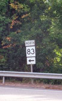 Start of Route 83 in Glastonbury, as seen from the end of the Route 2 eastbound exit ramp. Photo taken 2002 by Kurumi.