In the 1920s, State Highway 140 followed today's Route 80 between Route 22 and Route 77.
The modern Route 140 was commissioned in 1932, and originally followed this route, going eastward, for a length of 10.65 miles:
- Phelps Road and Scantic Road from US 5 to Mill Street, E. Windsor; this is now part of Route 191.
- Mill Street to Church Street (also part of 191)
- Church Street to Main Street. This is now a town road.
- Main Street (also part of 191) to Melrose Road (which is also Route 140 today)
- Today's Route 140, toward Ellington center
- A section of Main Street (today's Route 286) to end at Route 83.
A short leg of Maple Street, called Route 140A, connected Ellington Center northeasterly to Route 83.
From 1932 to 1962, Windsorville Road and Main Street, from Reservoir Road north to Church Street in Broad Brook, was SR 913. At some point Route 140 or 191 was moved from Church Street to Mill Street, taking a few blocks away from SR 913.
In 1932, here's what segments of present-day Route 140 were called at the time:
- From Route 75 to Route 159: became the old Route 78 in 1935
- From Route 159 to Main Street in East Windsor (including the bridge): part of Route 20.
- From Main Street in East Windsor to Main Street at Broad Brook: part of Route 191.
Three generations of bridges at Warehouse Point
Route 140 crosses the Connecticut River on a two-lane box girder bridge, 1,134 feet long, built in 1992. This is the third bridge to be built at this point.
In October 1886 an impressive-looking suspension bridge was built by the Warehouse Point Bridge and Ferry Company, replacing a ferry at that location. The bridge featured a 550-foot main span and two 300-foot side spans; the idea was to minimize the number of piers in the river and their effect on power wheels immediately upstream. That bridge charged a toll for all traffic until the state purchased it and made it free in July 1908: the first free bridge across the Connecticut River in the state. This was the first step in the state's plan to own and control all bridges over the river. (See more info and photo for this bridge at BridgeMeister.com.)
However, as motor traffic increased – especially truck traffic from the region's tobacco fields – the old bridge became unsafe and obsolete. Keeping it in good repair was increasingly expensive. In 1919, Hartford County received approval to build a $350,000 iron truss bridge to replace it. The second bridge opened, at a final cost of about $500,000, on Dec. 2, 1921. The county hoped to sell the old bridge for scrap, but could not find a way to cover expenses of demolition. The state began tearing down the old bridge in 1924.
Fast forward a few decades, and the 1921 bridge was also growing obsolete. In 1967, the state posted a maximum load of 15 tons, requiring heavier trucks to use the Dexter Coffin Bridge on I-91 instead. In 1983, after the collapse of the Mianus River Bridge on I-95, the DOT initiated a statewide emergency bridge repair program. The decision for the Route 140 bridge was to replace instead of repair; the new bridge opened in 1992.
New Bradley Connector prompts area renumbering
In July 1961, the new Bradley Airport connector opened; the state made this part of Route 20, with that designation now ending at I-91. To account for the remainder of Route 20, a road leading to Union at the time, the state rearranged nearby highways. Route 140 and Route 191 basically switched places west of their intersection in Broad Brook. Then Route 140 continued westward, replacing old Route 20, following Spring Street in Windsor Locks to end at Route 75.
In 1962, Route 140 was moved from Spring Street to Elm Street in Windsor Locks, one block south. This road had once been called Route 78.
In 1963, Route 140 was extended into Stafford, and absorbed the Route 140A designation.
In the late 1990s, a segment in East Windsor and Ellington was reconstructed, with several sharp curves smoothed out. In 2002, another section in eastern Ellington near Crystal Lake was realigned.
Route 140 Freeway
In 1961, the state forecast a need for an expressway from Windsor to Bolton, serving as an outer ring road to the Hartford area. The number assigned to it was 140. (See map at Metro Hartford's Proposed Freeways for a notional alignment.)
The highway was never built; in 1963, Route 140 was extended to Stafford instead, making a reroute to Bolton even more drastic. In 1967, the Capitol Region Planning Agency proposed a similar expressway from Windsor Locks to Tolland, as part of an extended Route 20, but no such plan is active today.
Unsafe junction with Route 83 fixed
In 1977, the DOT considered the intersection of Route 83 and Route 140 in Ellington as one of the most dangerous in Connecticut, and announced it would seek federal funds to fix its problems. An incline on Route 140 eastbound at Route 83, and a sharp right turn for southbound traffic, created such a hazard that the town ambulance would routinely go west on Route 140 and use Route 286 instead to reach Route 83.
This was eventually fixed; Route 140 now meets Route 83 at a gentler four-way intersection across Cider Mill Road.


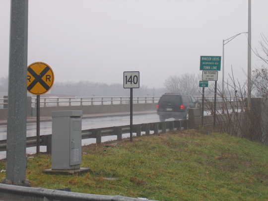 Looking east across the Connecticut River on Route 140, at the site of the former iron truss bridge at Warehouse Point.