A Popular New Road
Route 80 was commissioned in 1932 from the 1920s State Highway 175. At the same time, the road was being rebuilt as a 40-foot-wide inland alternative to the congested US 1 east of New Haven. Route 80 served as the model for the Merritt Highway in Stratford, which was later redesigned as the four-lane divided Merritt Parkway.
In 1935, the Automobile Club of Hartford highlighted Route 80 as part of a round trip via Middletown to North Branford and Deep River:
Traveling eastward on Route 80 is a motoring experience which every automobile owner will welcome. The road is similar to those found so extensively in Massachusetts. It cuts through virgin woods, swings across ravines and passes new watering places that are being opened up for homesites. At North Madison it swings around one of those modernistic traffic circles [at Route 79] just now nearing completion.
In the spring of 1940, the state upgraded navigation signs along Route 80, based on good results from an earlier effort along Route 2, which engineers were calling "The Laboratory Road" in that respect. This was done to help relieve projected summer traffic along the Boston Post Road.
Route changes - west
At a period during the 1950s, Route 80 extended west to Route 10 in New Haven, along Munson Street and Henry Street; it was rolled back to Route 17 in 1962.
Route changes - east
In the east, Route 80 originally ended in Deep River, as now. In 1940, to emphasize its role as a US 1 bypass, it was rerouted and extended to US 1 in Old Saybrook. Its route, branching southeast from present-day Route 80 in Deep River, was:
- Warsaw St, N. Main St, and Main St. (today's SR 602) into Essex. The previous designation of this road: Route 17 (no relation to the current Route 17).
- Middlesex Tpke. (now part of Route 154)
- Essex Rd. to a trumpet interchange at US 1; this was replaced by the Route 9 interchange with I-95
On Jan. 2, 1967, shortly after Route 9 opened in the area, the state announced Route 80 would once again follow W. Elm St. and Elm St. to Deep River.
Widening in New Haven area
Route 80 has been widened to four lanes in a few sections:
- about 1.75 mile between I-91 and Mill Street in East Haven in the 1980s
- a short segment of the overlap with Route 22 in 2001, to around Twin Lakes Road
- continued widening through the eastern 80/22 junction in North Branford, around 2014. The intent had been for this work to start around 2001.
Freeway Plans
In the 1940s, the New Haven Postwar Master Plan included Route 80 as a freeway/boulevard from Route 10 eastward into Branford. There would be interchanges at Route 10, US 5, and US 5A (now Route 103).
Furthermore, a 1967 state "Grid Analysis" future needs map proposed a freeway along Route 80 and Route 82 from New Haven to Norwich.
Revised interchange at I-91/Route 17: moribund?
The state was planning an upgrade to the interchange at I-91 (exit 8) and Route 17. A public hearing was held on Oct. 22, 1997. What they wanted to do (I haven't heard anything about it since then):
- Realign the existing I-91 northbound off-ramp to make it a two-lane exit.
- Eliminate the portion of the existing northbound off-ramp that provides through access to northbound Route 17.
- Add a second northbound off-ramp approximately 1/3 mile north of the existing ramp to intersect Route 17 at Flint Street (near the existing onramp).
- Relocate the existing northbound on-ramp to accommodate the new off-ramp.
- Widen Route 17 to four lanes from Route 80 to Flint Street.
Scenic road designation sought in Madison
In February 2003, Madison officials announced their intent to have US 1 in town designated a state scenic road. They said they would follow this up with an application for Route 80 between the Killingworth Town Line and Dream Lake; and also for Route 79.
Route 80 has some scenic ledges in the area and should be a "no-brainer" for the designation, in the words of a town Planning and Zoning Commission alternate.


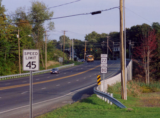 Looking east along Routes 80 and 22, just after they join in North Branford. Photo taken by Kurumi in September 2002.