
Updated Oct 20, 2018
 Entrance sign at Route 124 shows the unique font and design elements on new Merritt Parkway signs. The jagged edges evoke the original wooden signs that once lined the Parkway. Photo taken April 2004 by Kurumi.
The Merritt Parkway, a 37-mile stretch of Route 15 in Fairfield County, is known as the Queen of Parkways with good reason: it's the most scenic highway in Connecticut, and recognized as one of the most scenic of its kind in the nation.
Its landscaping and layout was arranged with great care, and each of the more than 60 original bridges has its own unique ornamentation. Owing to its location (away from urban centers), wide right-of-way (only half of which is occupied), and reputation as a scenic asset, the Merritt Parkway is largely unmarred by roadside commercial development, even as traffic has greatly increased over the years.
The Parkway is showered with attention, as highways go. It's in the National Register of Historic Places, an honor usually bestowed to significant buildings and homes. Two books written in the 1990s trace its history and architecture, and several web pages are dedicated to it.
However, preserving the Parkway's charm has required an active role among its supporters. It opened in sections from 1938 to 1940 – Connecticut's first controlled access highway – and if it had been left alone, would now be not only overloaded but unsafe and functionally obsolete.
The Parkway has changed over the years. The state has made several safety-related changes, a process that started in the 1950s and continues to this day, creating smoother ramps and longer acceleration lanes. Newer expressways, such as US 7, Route 8, and Route 25, now cross the Merritt Parkway, and their interchanges are necessarily out of scale compared to the 1930s design of other crossing roadways.
Several times the "doomsday" proposal for the Merritt Parkway has surfaced: adding travel lanes in each direction, which would require uprooting miles of landscaping and reconstructing every bridge along the route. However, this has not happened to date, and the Parkway remains at its original four lanes.
This was kind of long for an introduction, but I wanted to provide an "in a nutshell" description of the Parkway.
In the 1920s, traffic congestion along the Boston Post Road (US 1) in Fairfield County was already a problem. In 1923, state highway commissioner John MacDonald proposed three options for relieving the road: a parallel road for truck use only; a new road about 20 miles inland; or improvements to the Post Road with bypasses around congested areas. The parallel road option would be reconsidered in the mid-1940s as a general-purpose express highway, which opened in 1958 as the Connecticut Turnpike. The inland road, endorsed in 1925 by Gov. Wilbur Cross, eventually opened (though closer than the original 20 miles to shore) as the Merritt Parkway.
Though the Parkway opened as a four-lane divided highway with controlled access (with a few temporary at-grade crossings), the original plans were much less ambitious, and would not have resulted in a road with the national prominence it enjoys today. At the start of the 1930s, the state was building Route 80, a new two-lane bypass of US 1 between New Haven and Old Saybrook. In 1932, work began in Stratford on the Merritt Highway, built the same way as Route 80: 40 feet wide, undivided, at minimal cost. Instead of continuing toward Hartford over the Housatonic River, the Merritt Highway would have instead paralleled today's Route 108 southeast to end at US 1 and East Main Street in Stratford.
Fairfield County residents displeased with the pedestrian nature of the planned road formed citizen's groups to protest the plans. Eventually the Merritt Parkway Commission prepared a parkway plan from Greenwich to Stratford, and work began on a parkway in Greenwich in 1934. Legislation was passed to reroute the highway from the terminus at US 1 in Stratford to a new inland bridge over the Housatonic River.
On June 29, 1938, the first 17.5-mile segment of the Merritt Parkway opened, from the state line to Norwalk. In November 1938, the Parkway was extended to Route 57; and in November 1939, to Huntington Turnpike (near Route 108). On Sept. 2, 1940, the remaining 20 miles, including the steel-deck Housatonic River bridge opened, completing the road from there to New York. The total cost was $20 million.
When the Merritt opened, a few at-grade intersections remained, including one at the Newtown Turnpike (the bridge was not complete), and at Rocky Hill Road in Trumbull (until it was rerouted). Rocky Hill Road is now split by the Route 15/25 freeway interchange; Leo Auray writes that the Rocky Hill Road overpass (formerly a railroad bridge), though now abandoned, remains standing.
Exit 30, Butternut Hollow Road, was an at-grade intersection with the Parkway until 1955, when the median crossing was closed. Right-turn entrance onto the Parkway was still permitted, but after a series of accidents, this was closed as well. (It's not far to exit 29.)
The original Parkway construction was marred by the Kemp Land Scam, named after G. Leroy Kemp, in charge of land acquisition for the right-of-way. Since Highway Commissioner John MacDonald was keeping the route secret, Kemp took advantage of insider knowledge, negotiating inflated prices for parcels and splitting the commission. Though he covered his tracks, he was eventually convicted in front of a grand jury in January 1938. MacDonald was forced to resign three months later.
The parkway is best known for its bridges; all 68 of them have uniquely designed masonwork and ornamentation. Counter to the misconception that each bridge is the work of a different artist, all were designed by George Dunkelberger. Bruce Radde's "The Merritt Parkway," published in 1993, includes photos of nearly all of them.
On June 21, 1939, tolls were added to the Merritt Parkway, not to pay for its own upkeep (a common misconception) but instead to finance an extension to Hartford. The toll barriers spanned the through traffic lanes, meaning all traffic would stop, pay a dime, and continue; compare this to the Massachusetts Turnpike, where motorists get a ticket at an entrance ramp and pay a calculated toll where they exit.
The tolls were a success: by the late 1940s, a combination of four-lane highways carried motorists from Greenwich, and the Merritt Parkway, to Hartford.
Barrier-style tolls were also installed on the Connecticut Turnpike (I-95) when it opened in 1958. The safety problems with this setup were emphasized in a multiple fatality accident in 1983, where a runaway truck struck several cars stopped at a tollgate. In the aftermath, the state worked to remove all tolls, and on June 25, 1988, tolls were removed from the Merritt and Wilbur Cross parkways.
The Merritt Parkway opened without numbered exits: destination signs were the way motorists found their way around. Maps handed out at toll stations helped drivers judge how far they were to their turnoff.
As a response to safety problems caused by last-minute exit choices, exit numbers were added in 1947. Numbering started at 27 (King Street) for continuity with the Hutchinson River Parkway. Instead of lettered suffixes, the few cloverleaf interchanges on the Merritt were given two consecutive exit numbers, such as 39 and 40 for US 7 south and north.
The Hutchinson River Parkway has had some exits renumbered since, so the shared interchange with King Street straddling the state line has two exit numbers: 30 (New York) and 27 (Connecticut). There's more King Street weirdness at my Route 120A page.
Though a planning number for the Merritt Parkway was legislative route 1A, denoting a role as a bypass for US 1, the Parkway had no posted route number for the first 10 years of its existence.
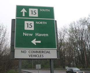
As the state began stitching together a cross-state highway, it was possible to travel from Greenwich to Union on mostly modern, new highway. However, the road changed names seven times, leading to motorist confusion. To help guide the way, the state used an existing number – Route 15 – to apply to the entire route, including the Merritt Parkway.
On April 17, 1991, the Merritt Parkway was listed on the National Register of Historic Places – uncommon for a highway. In late 1999, a conservancy was formed to maintain and protect the landscaping and bridges. Only one other road has a conservancy formed for it: New York's Bronx River Parkway.
The Parkway was built in the northern half of a 300-foot right of way, whose primary purpose was to control access to the road; not until 1939 did the state have the legal right to restrict access to a highway, so it created a buffer zone of purchased land. In the intervening decades, this buffer has helped the Parkway keep its pastoral setting.
A secondary purpose for the extra right of way, even in the 1930s, was to accommodate future widening, when traffic grew to overwhelm the original parkway. A 1935 George Dunkelberger sketch of the Round Hill Road overpass shows a planned duplicate bridge to the south, to span four additional parkway lanes.
"We must have explained this a dozen times. We are not building an eight-lane expressway."
In the 1970s and 1980s, the state examined solutions to growing traffic congestion in Fairfield County. Widening Interstate 95 would require costly land acquisition to augment its narrow right-of-way through the shoreline cities. On the other hand, the Merritt Parkway had 150 feet of unused space along its entire length. Where some saw an opportunity, by widening the Parkway to eight lanes, others feared the irreparable loss of its beauty, by the same deeds.
In 1973, the contention came to a head. The DOT wanted to straighten out some curves in the road, and create a wider median in some areas. Opponents claimed this was a prelude to widening the road outright, and decried the large interchanges planned with the Route 7, 8, and 25 freeways.
Another idea, though under the rubric of mass transit, was even more unconvential: running a $700 million monorail down the Merritt median. I'm not making this up; see the March 14, 1985 Stamford Advocate.
The mainline of the parkway has been left alone, although several interchanges have been modernized. The interchanges with Routes 25 and 8 are quite modern, but otherwise the state has since been more sensitive to the landscape and lay of the road. The consensus in the 1990s was that the Merritt Parkway would not be widened. (However, the issue resurfaced in 2002; see "Future", below.)
"I think for us to just walk away from this [widening the Merritt Parkway] as a possible solution to a horrendous problem - that's getting worse every day - and just take it off the table is a huge mistake."
In late 2002, however, the widening idea resurfaced. Many state Transportation Strategy Board members favor studying the feasibility of adding lanes: an option completely off the table for many observers. The Southwestern Regional Planning Agency, which also studies area transportation issues, is not considering widening the Parkway.
In December 2003, state Sen. William Aniskovich suggested widening the Merritt and Wilbur Cross parkways to six lanes, and to consider letting smaller trucks use the parkways. The head of the Motor Transport Association of Connecticut favored opening both parkways to trucks.
The state Transportation Strategy Board in June 2003 rejected adding any lanes to the parkway.
The Wilbur Cross Parkway served as the eastward extension of the Merritt, part of a plan to connect Fairfield County with Hartford and an eventual statewide expressway network. The section from the Housatonic River to Route 34 opened on Dec. 24, 1941, but the rest was delayed by World War II restrictions. The highway was complete (up to Meriden) in 1949.
For more information, see my Wilbur Cross Parkway page.
The state had planned to extend the Wilbur Cross Parkway as a controlled-access highway to Hartford, but this was never done. Instead the four-lane Berlin Turnpike filled that role, a divided highway with at-grade intersections and a few interchanges. In 1965, Interstate 91 opened to the east, providing Meriden to Hartford travel without traffic lights.
For more information, see my Berlin Turnpike page.
The Sikorsky bridge, the 1,800-foot open-grate structure crossing the Housatonic River at the Merritt-Wilbur Cross transition, was replaced circa January 2007. In December 1998, the state put to bid a project to replace the bridge, with a six-lane structure (four thru and two operational) including a bike path/walkway on the north side.
Most drivers don't lament the old slippery steel grate surface of the original bridge; however, ConnDOT said the primary reason for replacing the bridge is the eroding steel in the support structure. In Nov. 2003, a ConnDOT representative said the 1940 bridge is in "good shape, but functionally obsolete for the traffic it carries."
In November 2000, the contract was awarded to Balfour Beatty Construction, Inc. of Atlanta, Ga. for $83.7 million. In November 2003, the first span opened and traffic was shifted to it, clearing the way for the old bridge to be demolished.
An obscure urban legend (or "suburban legend") is the idea that the steel grate was mistakenly designed or installed upside down; but there's no truth to that.
The state has been and will continue to modify several interchanges along the Merritt Parkway: lengthening merges, smoothing out ramp curves, and sometimes removing ramps to simplify access. Completed and planned changes (from the southwest region TIP) are:
In May 2001, the state put to bid a project to replace the interchange at Route 111 (Main Street, Trumbull) with a Single-Point Urban Interchange (SPUI). It was completed in 2004 and is the state's first. Others are planned on the Berlin Turnpike at Route 175, and on I-84 at exit 46.
Now a SPUI is incompatible with the 1930s-era Route 111 overpass, which had to be replaced. The DOT press release says the "design of the new bridge replicates the significant design elements of the existing bridge, including color, texture, and the various architectural treatments of the exposed surface of the concrete."
The Merritt Parkway isn't universally used as a positive comparison. One poster on rec.travel.air said this of Washington, D. C.'s National Airport: "Planes used to be smaller and travel at much lower speeds, so landing was not as difficult. The flightpath takes aircraft over or near very important buildings (Pentagon, White House etc.). I can assure you that the Secret Service would very much like to see it closed. It is the Merritt Parkway of U.S. Airports."
The Merritt Parkway, at one time on David Letterman's commute, has appeared in his Top Ten lists: