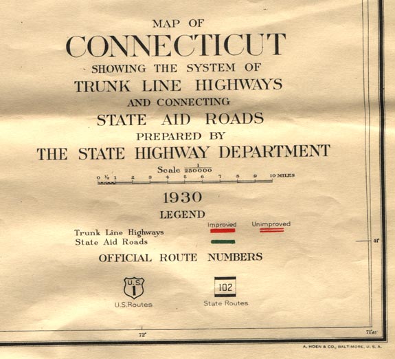
The Map Inside: Connecticut Officials: 1930
This exhibit shows how the Connecticut official tourist map has changed since the 1930s. You can start with the introduction or browse year to year. The scans may not be actual size (150 dpi), but are consistent with each other.
Other years:
1930
1934
1935
1938
1941
1942
1943
1949
1952
1955
1956
1957
1959
1960
1961
1963
1965
1971
1972
1975
1989
1998
2000
2001
2002
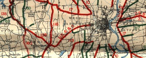
State maps did not include city insets until 1941, so we instead show a double-wide main map sample of the Hartford area. This map predates the "Great Renumbering" of 1932 and shows the different route numbering system in place at the time. For example, Route 17 west of Hartford is now US 44, and Route 116 is part of today's Route 10.
The map features three-color overprinting on a black and white base: blue for water, red for trunk line (primary) routes, and green for state aid routes. We can see that not all state aid routes appear to be numbered; state responsibility is discontinuous, especially through cities; and some highways (like State Highway 160) are a mix of classification and pavement type.
This map has no cover at all; the back is completely blank. Below is the map legend.