Introduction
When Interstate 384 peters out at Bolton Notch, drivers on US 6 eastbound might be forgiven for thinking roadgeek opportunities won't resurface until Providence: a long drive down a mostly two-lane road, despite the taunting "I-384 / Providence" signs in East Hartford.
Sure, on "Suicide 6" along the Hop River, you'll be entertained trying to stay alive; and at Willimantic, there's another abandoned piece of I-84 where you can pass that dump truck you've been tailing for the last 11 miles. But after that... what?
Improvement in Danielson
In the city of Danielson (town of Killingly), bordering Rhode Island, US 6 is in pretty good shape: a long four-lane section, much of it divided, with a fully controlled interchange at I-395 and another easily overlooked "super 2" interchange at the Danielson Pike. Right at the state line, a Y-interchange merges you with the very end of the original Connecticut Turnpike.
Not bad at all; in fact, Danielson is where US 6, completely out of the shadow of I-84, gets a chance to shine. On top of that, recent improvements in 1996 (though they made the road safer and wider) erased an earlier configuration that was much more interesting.
On this page, I'll talk about roads in Danielson and Killingly, especially the 6/12 interchange.
19th-century Turnpikes
In the 1800s, two toll roads crossed town. From about 1806 to 1851, the Connecticut and Rhode Island Turnpike went roughly where Route 101 does today. From about 1825 to 1865, the Providence Turnpike, an extension of the Foster and Scituate Turnpike in Rhode Island, went roughly where US 6 does now.
The 1920s
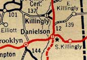
Danielson area roads in 1929. The red east-west road is US 6. (Socony Road Map of New England, 1929) |
In 1922, a new network of New England numbered roads was created, and within a year Connecticut had started a system of statewide numbered roads. New England Route 3 followed US 6 from Danbury toward Cape Cod, but used the Danielson Pike through town (as did US 6 until the 1950s). New England Route 12 is now state Route 12. State highways 137 and 139 followed the approximate path of today's Route 101.
The Connecticut Turnpike
... was also called the Greenwich - Killingly Expressway, denoting its two endpoints. It fully opened in 1958. One rumor I've heard (but haven't officially confirmed) is that the state built the northward sweep from Norwich hoping that Interstate 95 would follow the same route and spend more time in Connecticut. This didn't happen, and I-95 instead was built closer to the shore, entering Rhode Island at North Stonington.
I'll talk about the "elbow" in the Turnpike occasionally. That's where the original turnpike diverges from I-395 and heads east-northeast toward Rhode Island. The portion of I-395 north of the elbow was built a few years after the Turnpike opened.
When it opened, the Turnpike provided a two-lane north-south roadway from the elbow to US 6, called the Danielson Connector. That was roughly in the path of today's Interstate 395, and is now gone.
The turnpike spur has never had a public route number. Officially, it's state road 695. This internal designation sometimes shows up in the press or on maps. This numbering predates the I-395 numbering, and in no way implies there was ever an I-695 planned. It's just a coincidence.
Route 52 and I-395
In the late 1950s, as the Connecticut Turnpike opened, the state was already planning a "Route 12 relocation": a freeway paralleling Route 12 into Massachusetts. One reason for the proposal was to boost the local economy, and some called the proposal "a ribbon of hope." Parts of this ribbon started opening in the 1960s. On Sept. 15, 1964, it was given the number Route 52.
In 1983, Route 52 was promoted to Interstate 395, for a few reasons. For one, it would have given the planned Interstate 84 a place to end, since Rhode Island had cancelled its portion. Also, the cachet of an Interstate highway could provide an economic boost, continuing the "ribbon of hope" theme.
Interstate 84
In the mid-1950's, the state proposed building an expressway for US 6 east of Hartford to the Rhode Island state line. In 1968, approval was given to add this proposal to the interstate highway system, and it was decided to reroute I-84 to end in Providence. The planned I-84 would probably have used the Turnpike spur along with new roadway west of Route 52 (now I-395).
However, environmental concerns eventually killed the proposal, and I-84 was abandoned in 1983. The state instead devised smaller improvements to specific portions of US 6.
US 6 and Route 12
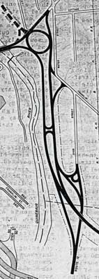
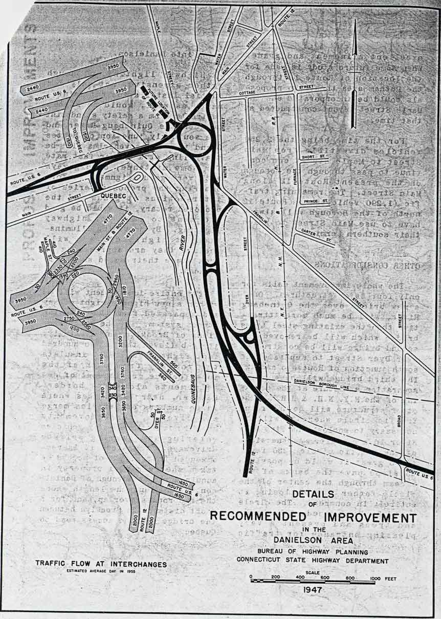
1947 plan for US 6 / CT 12 intersection. This was built in 1958, but revised again in 1996. The rotary and grade separation are gone. (See larger picture) |
US 6 originally followed Main Street and Route 12 northeasterly through downtown Danielson, then followed Westcott Road to join today's alignment toward Rhode Island. In the 1940s, a route to the south was proposed, letting through traffic bypass the central business district (see figure from 1947 plan). The figure mentions a proposed relocation of Route 12 to the west which never happened.
In 1958, this was implemented mostly as shown, with a rotary at the northern 6/12 intersection and a grade separation at the southern. The former US 6 (Westcott Road) became US 6A (and is now SR 607 and SR 618).
Also in 1958, the Connecticut Turnpike opened to the south and east, along with a two-lane Danielson Connector leading from the Turnpike "elbow" (see "Turnpike", above) northerly to the new US 6.
By 1960, a Relocated Route 12 was under construction at the eastern edge of Danielson. The new Route 12 would proceed north from the elbow, serving Killingly and Putnam, continuing toward Worcester. A segment incorporating the Danielson Connector and extending to Route 101 opened in 1962; this included a partial cloverleaf with US 6. Movements between the south and east (ramps not included in the cloverleaf) were and are still served by the last few miles of the Turnpike.
In the 1990s, it was apparent the 1947 design for the 6/12 improvement was no longer serving traffic well. US 6 narrowed to two lanes under a railroad bridge between Route 12 and I-395, and the rotary and grade separation were probably underpowered and a little confusing. In 1992, US 6 west of the rotary was widened to four lanes, and in 1996, the state revamped the 6/12 overlap, this time with conventional signalized intersections and a continuous four-lane profile for US 6.
Links
Sources
- "Proposed improvement in the Danielson area." Connecticut Highway Commissioner's Office, Bureau of Highway Planning Studies, Dated 1947.
- "Highway Dept. Tacking Route Labels on Turnpike." Hartford Courant, Aug. 25, 1964.
- Route Change Notice, ConnDOT, June 28, 1983.
- Nichols, Lyz. "Connecticut Roads [6/12 rotary]." Personal email, April 2, 2001.