Pre-20th Century
Route 14 is one of those highways that really does follow an old Indian path: settlers in the area were pleased to find a "remarkably straight" Indian trail in Windham County, leading from Canterbury to Narragansett Bay. This trail soon served as the main street for villages in its path and was extended to Windham; then became known simply as the "Great Road."
On Aug. 17, 1706, the Town Council of Providence ordered a road laid out leading to Plainfield, which was then an important commercial center. The road, then known as the Great North Road, is today the Plainfield Pike.
Titles aren't everything; by 1712 the legislature recognized the "Great Road" was poor even by 18th century standards and recommended improvements. Not much happened, however, until some funding arrived, under the sponsorship of the new Windham Turnpike Company in 1799. The corporation operated the road from Coventry to Plainfield along what are now roughly Routes 31 and 14. In 1852, the company folded (the turnpike era was fading), and control reverted to the towns.
The turnpike (and today's Route 14) included Main Street in Windham, laid out in 1707 to help farmers gathering hay along the Willimantic River.
1920s
In 1922 or 23, State Highway 103 was commissioned from Route 12 in Plainfield to Providence. In the late 1920s, SH 141 was added from Willimantic to Plainfield. These later became parts of Route 14.
1930s: 135 miles long
In the 1932 renumbering, Route 14 was created, and was much longer than it is now. It included SH 141 and SH 103 from Willimantic to Providence, but also incorporated 65 miles of additional roadway leading through Middletown, Meriden, Waterbury, and Woodbury. Parts of the original Route 14, which extended nearly 90 miles within the state, are now Route 64, Route 322, and Route 66.
Route 14's alignment through Plainfield was different from today's: entering from the west, it followed present-day Route 14A (Canterbury Road and Railroad Avenue). It then overlapped with Route 12 for 2.8 miles, finally going east along present-day Route 14. Black Hill Road and School Street, part of today's Route 14, comprised unposted State Road 580.
1941: Route 14 truncated
In the 1930s, Route 14 became known as an alternative to congested US 6, which passed through Hartford. The 1938 travel book Connecticut Guide recommended it as a "a smooth, speedy, and scenic cross-state route."
In late 1940, the state announced it would renumber all of Route 14 west of Willimantic as US 6A: most likely in order to encourage more use of this alternate route. The change took effect on Jan. 1, 1941. Its new length inside the state was 26.48 miles.
1960s: US 6A deleted; Route 14A created
When Interstate 84 and other expressways appeared, US 6A west of Southington grew less important for thru traffic. In 1968, the state decommissioned the route and assigned various parts to the state routes (64, 322, and 66) we have now.
In Waterbury and Meriden, US 6A (nee 14) was largely turned over to the city.
In 1963, as a result of the state's route reclassification, Route 14 was straightened out in Plainfield, and Route 14A created from part of Route 14 and other state roads.
Other small changes
In 1962, Route 14 was moved from its Old Plainfield Road alignment (east of Route 169) to Lovell Lane, improving the former dogleg along Route 169 to a 4-way intersection.
I'll Rochambeau you for it
Gen. Rochambeau's march to Yorktown during 1781 entered Connecticut on what is now Route 14.


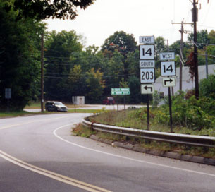 Route 203 approaching Route 14 in Windham. Photo taken Sept. 2002 by Kurumi.