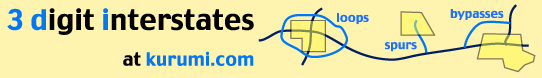
These icons (
I-890 New York (link)
9.35 miles [1![]() ]; loop north of I-90 in Schenectady. Partly done in 1965.
]; loop north of I-90 in Schenectady. Partly done in 1965.
This number was also considered for the "Outer
Beltway," an outer loop through Buffalo's second ring suburbs. The road survives in
small portions as Milestrip Road and the LaSalle Expressway in Niagara Falls.
[3![]() ]
]
A New York state highway was once planned to continue west across the Mohawk River
through western Schenectady County, and end at NY 50 in southern Saratoga County.
Until around 1990 drivers were "forced" off at the last exit, which went to
the NY Thruway (I-90) and surface road NY 5S. The concrete pavement continued
for a few hundred feet, heading toward the underside of a couple bridges for ramps
that were never built, and the Mohawk River.
("bridges to nowhere over nothing!") [2![]() ]
]
The state rebuilt the interchange slightly so the road to NY
5S crossed through the "eastbound" lane of weedy concrete, to improve that
road's access. In early 1999, the freeway was extended across the river (utilizing
the bridges to nowhere) to NY 5.
The new section of road is signed state route 890, which is no surprise to those
who have seen state routes 481, 690 and 787 do the same thing. [2![]() ]
]
See also: I-890 Map, Exit list (Chris Jordan)
Sources
- Route Log and Finder List - Interstate Highways, FHWA, Oct. 31, 2002.
- Moroney, Michael
- Tasman, Dan. 'The X90 Interstates.' Personal email, April 16, 1997.