SimCity
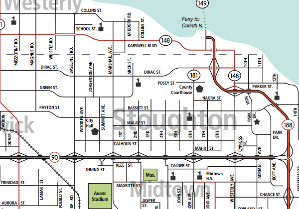
Back when I had more time, I played with SimCity 4, slowly fleshing out a highway system. "Mayor Tutorial" became Stoughton, the largest city in the Tri-City Area, currently the linchpin of the MaxisLand Peninsula. About 10 cities in all were developed, most of them small.
 See also: full "1992" version of this map (pdf)
I ignore the SimCity dates on the various cities. Instead, I go by "Sim Years", where a year is pretty arbitrary (say, a few hours' worth of playing). The peninsula was discovered in Sim Year 1973; in 1989 over 100,000 people now live here.
The Tri-City Area includes the very first neighborhoods I created in SimCity. I didn't know what I was doing. Experienced SimCity players can probably locate these on the map: disjoint street sections created by AutoRoads, and so on.
The first areas in rough order are Midtown, Downtown, Berwick, Delmar, Garnerville and south Farnham.
In newer areas such as N. Farnham and Watterson, you can see more of a neighborhood grid pattern and separation of through routes. Each of these 'hoods has its own elementary school, commercial areas, parks, and so on.
Yes, most of the street names have a theme, many of them in-jokes.
Almost everything predated the Rush Hour expansion kit. First priority was the semi-directional T interchange at F-90 and F-188.
Making the Map:
- take screenshots of "no data" data view to show shoreline
- take screenshots of traffic data view for streets
- trace all these in Illustrator
- use 1-pt red on top of 2-pt black stroke for fwys
- use white dashed stroke on top of black for railroads
- save a copy as PDF
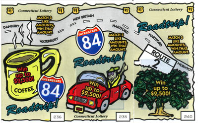
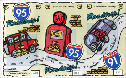
[Head] Scratchers
Sometime in the 1990s, Connecticut issued a set of lottery "scratcher" tickets with highway themes. The appeal of these is puzzling: the "Roadtrips" shown look more like commutes to the office.