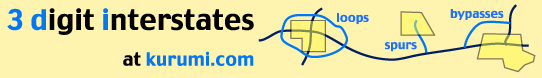
These icons (
I-505 California (link)
32.98 miles [2![]() ]; cuts south from I-5 in Yolo County to I-80 near Vacaville
(lit. "Cow Town"). Four lanes, straight, isolated; good shortcut from
Frisco area to camping and hunting in Northern California.
]; cuts south from I-5 in Yolo County to I-80 near Vacaville
(lit. "Cow Town"). Four lanes, straight, isolated; good shortcut from
Frisco area to camping and hunting in Northern California.
Interstate 505 is part of California's initial system of interstate highways,
submitted by the state June 27, 1945, and approved August 7, 1947. [10![]() ]
No numbers were assigned until the mid-1950s.
]
No numbers were assigned until the mid-1950s.
Numbering history
California's first proposed number for this highway was I-7, in August 1957.
The state's first group of submissions included no 3-digit numbers, instead using
numbers like I-13 for I-605 and I-72 for I-580. [7![]() ]
]
In April 1958, California prepared a revised numbering proposal, including 3-digit
numbers; but these were all in the low 100s, and not associated with parent
interstates. In that scheme, I-505 was to be called I-115. This plan was rejected
by AASHO. [7![]() ]
]
On Nov. 10, 1958, AASHO approved a California plan that included a split designation for Interstate 5. I-5E would roughly follow today's I-5 through Sacramento. I-5W would follow today's I-580 from I-5 to Oakland, I-80 to Vacaville, and I-505 back to I-5. The 5W numbering was dropped in favor of 505 and 580 around 1964. The 505 freeway was finished in 1977.
See also:
- I-505(Dan Faigin)
- California Interstate Route Numbering (Stephen Summers)
- Signing in California (David L. Kriske; photos include I-5W sign)
- Interstate Guide: I-505 (AARoads)
I-505 (cancelled) Oregon (link)
Unbuilt 1.44-mile Portland spur [1![]() ]; I-505 would have followed US 30 (Yeon Ave).
northwest out of Portland. Plans for this freeway were withdrawn in the late 1970s,
culminating with an approval by President Jimmy Carter to cancel it on Dec. 14, 1979.
[11
]; I-505 would have followed US 30 (Yeon Ave).
northwest out of Portland. Plans for this freeway were withdrawn in the late 1970s,
culminating with an approval by President Jimmy Carter to cancel it on Dec. 14, 1979.
[11![]() ]
]
The money was used for other construction projects in the Portland area,
including an alternate design for I-505. (The source doesn't elaborate
on this.) [11![]() ]
]
Part of the proposed route appears on a 1979 Gousha Portland city map. I-505 would have ended at I-405 at the Exit 3 ramps.
A 1970 proposal estimated the road at 0.7 miles and $3 million. [8![]() ]
A 1972 report has this summary:
]
A 1972 report has this summary:
The statement concerns the proposed construction of an urban freeway (Interstate 505) extending from a junction with Interstate 405 westerly to a junction with St. Helens Road (US 30) in Northwest Portland, Multnomah County, Oregon.The adverse environmental impacts include a general increase in land values in Northwest Portland, the relocation of individuals and commercial/industrial entities, changes in location and degree of noise levels, increased traffic density within the freeway corridor.
See also:
- Columbia River Highway (Lower) #2W (Mike Wiley; includes proposed I-505)
- Oregon Highways: I-505 (Mike Wiley)
Sources
- Route Log and Finder List - Interstate Highways, USDOT, 1978
- Route Log and Finder List - Interstate Highways, FHWA, Oct. 31, 2002.
- Summers, Stephen. "Interstate system route numbering." http://www.nwindianahwys.homestead.com/INTER_MAIN.HTML. (29 May 2003)
- Congressional Hearings, Federal Aid Highway Act of 1970.
- "History of California's Interstate Routes." California Department of Transportation, November 1984.
- Oregon Department of Transportation. "A chronological history of ODOT: 1899 to 1993." http://www.odot.state.or.us/ssbpublic/bss/rmds/history/~chron.htm (12 March 2004)